News
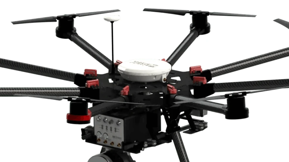
News in the universe of unmanned aerial vehicles (UAVs – or drones) are increasingly frequent, and advances in technology for their development, as well as the equipment and sensors they can carry, allow the generation of increasingly precise and detailed products. As an example of these sensors, we can mention the use of the LIDAR system in UAVs/drones, which will be addressed in this text.
Speak with one of our specialists and discover how Pix Force can transform your business
What is LiDAR and how is it used in drones?
By definition, the LiDAR (Light Detection and Ranging) system is a remote sensing method that uses pulsed laser to measure distances. The technology used allows for obtaining three-dimensional information about the Earth's surface with high precision.
Its working principle consists of emitting laser pulses with a high repetition frequency. Based on the recording of the reflection of these pulses, the LiDAR system creates position (x, y) and elevation (z) data with extremely high precision, generating a point cloud.
By combining these point clouds with orthophotos and using appropriate techniques, it becomes possible to create digital models of the studied surface in a precise and detailed manner.
The LiDAR system can be used to generate high-resolution maps for a variety of areas such as mining, topography, forestry, agriculture, industry, construction, environment, and others. In short, its use is relevant for the rapid and precise surveying and mapping of different types of infrastructure and natural resources.
Data obtained with the LiDAR system show the vertical aerial view (1) and profile (2) of the Bixby Bridge (3), in Big Sur, California (USA). The data were released by the National Ocean Service of the United States.
In their original form, LiDAR sensors are quite large and heavy, and because of this, their use in aerial platforms was limited to airplanes or helicopters, resulting in high costs for their utilization.
However, its high approval rating and the efficiency of its system led its developers to improve them, resulting in compact and much lighter versions, allowing them to be safely attached to UAVs/drones, lowering costs and facilitating their use.
Advantages of using LIDAR on drones
When carried on drones, the LIDAR system can be used to determine and/or monitor areas for any sector where an accurate representation of the scenario of interest is required.
It is advantageous compared to traditional recording and measurement systems because it can obtain a large amount of highly accurate data in a short period of time.
Furthermore, there are no limitations for measurement in hard-to-reach or large areas, as the speed in capturing information and the possibility of reaching restricted locations eliminate potential limitations.
The use of UAVs/drones to airborne the LIDAR system is highly positive and advantageous. Technological advancements in both technologies have been and continue to be of utmost importance for further progress in their construction and utilization, expanding their usage prospects.

Fabio Caraça
Fábio Caraça is the Chief Growth Officer at Pix Force. He leads Pix Force's transformation into a scalable SaaS operation, combining strategic vision, culture, and high-impact execution.