News
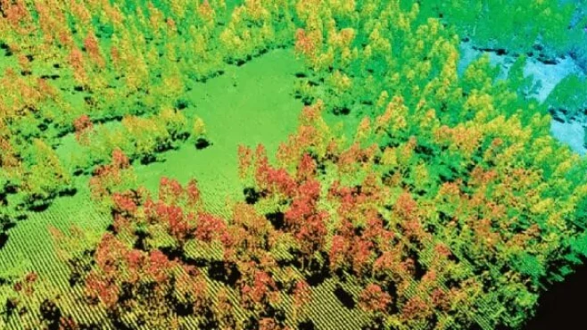
The future of remote sensing is increasingly accessible and revolutionizing technology. LiDAR (light detection and ranging) is a remote sensing system designed to measure the distance between objects. Through this system, it is possible to investigate natural and artificial environments with greater precision. It is through the use of LiDAR that many technologies have become possible to apply, such as autonomous cars and advanced computer vision systems. Basically, the system is a 3D sensor that emits beams of infrared light toward a specific target. The light signals bounced off nearby objects form a pixelated image called a point cloud. The system interprets this point cloud and faithfully represents the surface of an object. How can a remote sensing system be useful? It is through it that numerous developments can be applied to existing technologies. LiDAR is an accurate and advanced way of seeing and creating 3D representations of objects, an indispensable resource for various computer vision solutions and services.
Speak with one of our specialists and discover how Pix Force can transform your business
LiDAR and the automotive industry
One of the greatest synonyms of the "future", autonomous cars are still not a reality, despite unquestionable advances. Giant companies like Tesla, Uber, and Huawei have already realized the potential of LiDAR and are investing heavily in improving the sensor in their products and services. For autonomous cars to finally move from test sheds to the streets safely, LiDAR has been proving to be fundamental, as recognizing the presence of objects around the vehicle to prevent collisions is one of the greatest challenges for the definitive launch of autonomous cars. LiDAR identifies both the shape of objects and their distance from the vehicle, providing the necessary data for user safety. Until now, one of the major obstacles to exploring LiDAR remote sensing was that each unit cost, on average, 500 dollars. However, several manufacturers, such as the Chinese Huawei and the North American Velodyne, are already working to create a more affordable LiDAR. The estimate is that the device will cost around 100 dollars without compromising the sensor's quality and accuracy. The high demand for remote sensing systems is one of the causes of this price reduction. Not only the automotive industry, but several other sectors of Industry 4.0 benefit greatly from the application of LiDAR in their services and solutions (check here for more on other areas of LiDAR application).
The future of Industry 4.0
In practice, technology companies are no longer the only consumers of LiDAR. Embedded in new iPhones and iPads to assist with augmented reality features, Apple has made LiDAR accessible to everyday people and not limited to technicians and scientists. The value of LiDAR lies in its unique ability to measure and simulate reality with precision and provide complete, high-fidelity information. This means that this remote sensing technology can significantly impact forecasting models, such as meteorological and geological systems. Applied in drones, LiDAR directly assists in the measurement and reconnaissance of difficult and inaccessible terrains for humans. The geospatial analysis enabled by the combination of the two technologies can transform the way we see the world. Going in the same direction as Industry 4.0, LiDAR is a fundamental resource for the technological revolution shaping the 21st century. LiDAR is directly related to the concepts of computer vision, artificial intelligence, and machine learning. In an increasingly audiovisual and augmented reality concept of the future, these four tools are leaving the theoretical field. They are already in areas that are widely used and consumed. Sources: The Future of Lidar is Critical to the Future of Our World LiDAR is getting so cheap it’d be madness not to use it in self-driving cars Image by California Agriculture – Sierra Nevada Adaptive Management Project

Fabio Caraça
Fábio Caraça is the Chief Growth Officer at Pix Force. He leads Pix Force's transformation into a scalable SaaS operation, combining strategic vision, culture, and high-impact execution.